logo
  • Home
  • His life ...
    • Biography
    • Curriculum Vitae
    • Book: “Maximilien au Désert” NEW !
  • His work ...
    • Books
    • Expos
    • Painting
    • Embossings
    • New Year's wishesNEW !
    • Online ExhibitionsNEW !
    • Slideshows
  • Media ...
    • Documentation
    • Videos
    • Contact
  • Photo Gallery ...
    • All Photos
    • -
    • Sahara Rock Art completed
    • Tuareg
    • Pueblos
    • Northwest Indians
    • Peru
    • The culture of the Incas
    • Pre-Inca cultures
    • The Northern Andes Expanded!
    • The Central Andes Expanded!
    • The Southern Andes Expanded!
    • Argentina
    • Gauchos
    • Central America
    • Sahara 1962-1975
    • Sahel
    • Sahara : Tassili - Tadrart 1993
    • From the Ténéré to the Aïr Mountains
    • In the dunes of Erg Izane
    • Across the Tamgak Mountains
    • From Adrar Bous into the Tamgak Mountains
    • With the Tuareg on the edge of the Tamgak Mountains
    • Building a Tataram: Documentation
    • The Spice Route – Spices NEW !
    • The Spice Route – Java and Sulawesi NEW !
    • The Spice Route – Moluccas NEW !
    • The Spice Route – Malaysia, Singapore and Sri Lanka NEW !
    • The Spice Route – India : Kerala, Goa and Mumbai NEW !
    • The Spice Route – India: Rajasthan NEW !
    • The Spice Route – Africa – Europe NEW !
  • Comments
    flag flag flag flag    

Description

  • Foto Number: AND-276

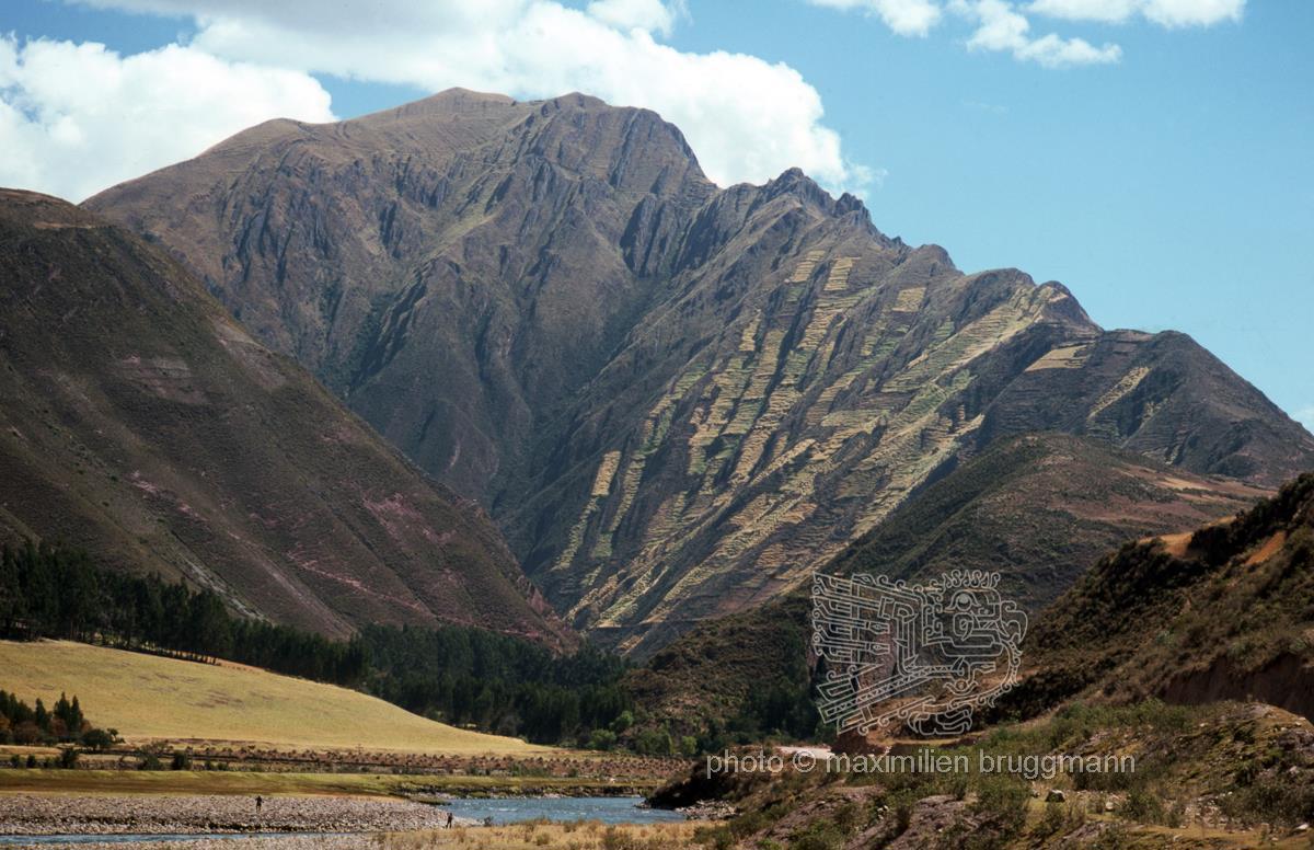
It was not only in the area around Cusco that the Incas made intensive use of the steep slopes for terraced farming (andenes) to secure food supplies for the surrounding settlements. These are stepped, flat terraces dug into the ground on steep mountain slopes and supported by stone walls, which thus prevent soil erosion during heavy rain. The stones of the walls store heat during the day and release it to the plants at night (protection against frost). – This photograph was taken south of Cusco on the road between Checacupe and Urcos, on the upper reaches of the Vilcanota River, which flows downstream to join the Urubamba River. Peru – 1976

  • Keywords:
    South America Peru Checacupe Urcos Río Vilcanota Central Andes Andenes

Description

  • Foto Number: AND-276

It was not only in the area around Cusco that the Incas made intensive use of the steep slopes for terraced farming (andenes) to secure food supplies for the surrounding settlements. These are stepped, flat terraces dug into the ground on steep mountain slopes and supported by stone walls, which thus prevent soil erosion during heavy rain. The stones of the walls store heat during the day and release it to the plants at night (protection against frost). – This photograph was taken south of Cusco on the road between Checacupe and Urcos, on the upper reaches of the Vilcanota River, which flows downstream to join the Urubamba River. Peru – 1976

  • Keywords:
    South America Peru Checacupe Urcos Río Vilcanota Central Andes Andenes

Website © 2026 pb + StratLabs
Copyright © Estate of Maximilien Bruggmann for all photos. Any use for commercial purposes prohibited.
flag flag flag flag