Description
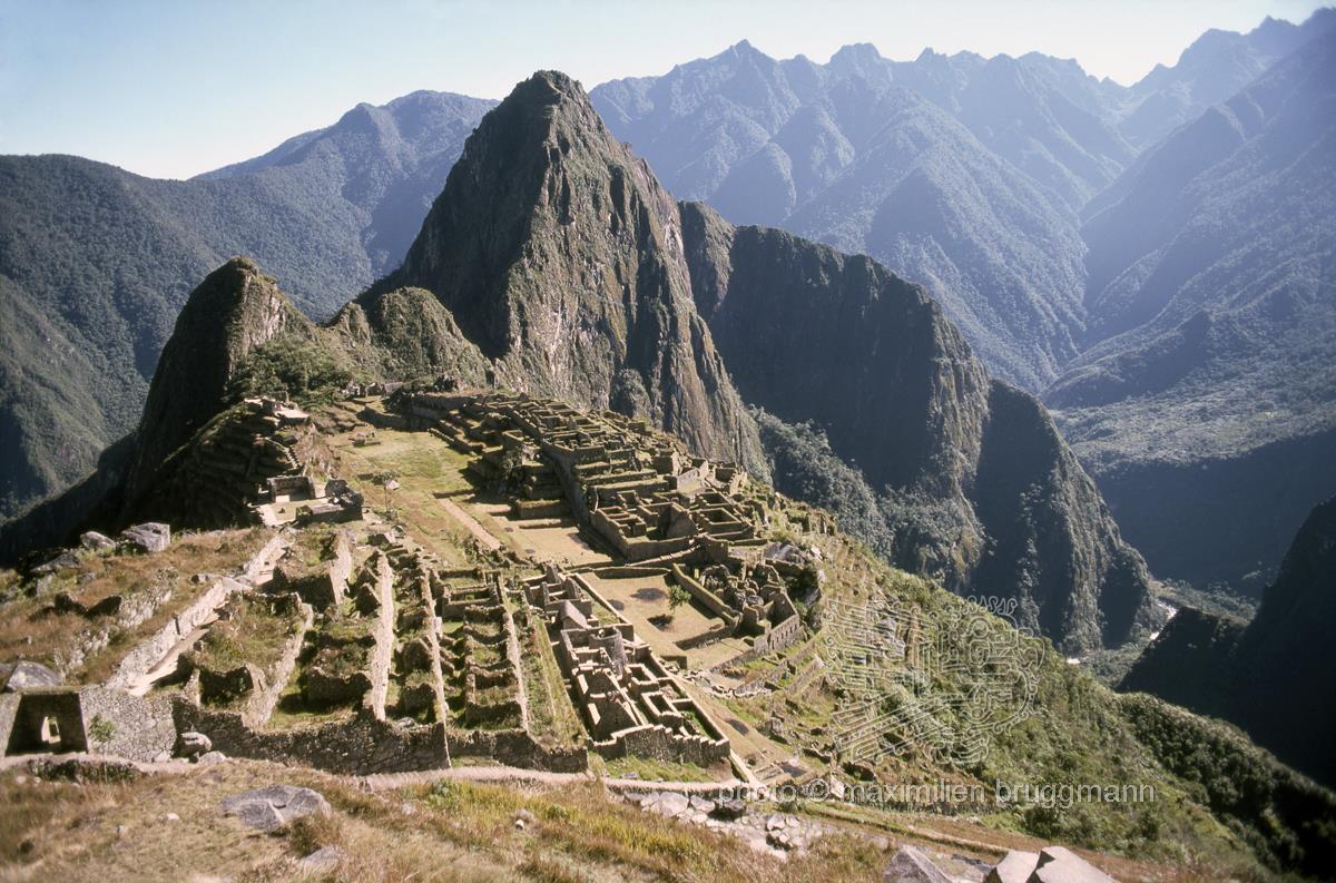
The Inca mountain fortress of Machu Picchu, situated at an altitude of 2,690 metres, set against the cone of Huayna Picchu. None of the Spanish conquistadors mention this city on the edge of the jungle, overlooking the River Urubamba (on the right), one of the headwaters of the Amazon. Like other pucaras (fortified settlements), Machu Picchu was self-sufficient in an emergency, but the terraced fields could feed no more than 500 people. This late Inca complex contains buildings of various styles, foremost among them the Royal Palace, constructed from beautifully hewn granite blocks with trapezoidal gateways and window openings. But there are also densely packed, simple stone huts and barrack-like quarters for the soldiers. An oval tower – the only one of its kind – has led to speculation that Machu Picchu was further expanded even after the arrival of the Spaniards. The city was not discovered until 1911 by an expedition searching for the legendary last Inca fortress, Vilcabamba. - Book: Picture 81 - Peru - 1976
Description
The Inca mountain fortress of Machu Picchu, situated at an altitude of 2,690 metres, set against the cone of Huayna Picchu. None of the Spanish conquistadors mention this city on the edge of the jungle, overlooking the River Urubamba (on the right), one of the headwaters of the Amazon. Like other pucaras (fortified settlements), Machu Picchu was self-sufficient in an emergency, but the terraced fields could feed no more than 500 people. This late Inca complex contains buildings of various styles, foremost among them the Royal Palace, constructed from beautifully hewn granite blocks with trapezoidal gateways and window openings. But there are also densely packed, simple stone huts and barrack-like quarters for the soldiers. An oval tower – the only one of its kind – has led to speculation that Machu Picchu was further expanded even after the arrival of the Spaniards. The city was not discovered until 1911 by an expedition searching for the legendary last Inca fortress, Vilcabamba. - Book: Picture 81 - Peru - 1976