logo
  • Home
  • His life ...
    • Biography
    • Curriculum Vitae
    • Book: “Maximilien au Désert” NEW !
  • His work ...
    • Books
    • Expos
    • Painting
    • Embossings
    • New Year's wishesNEW !
    • Online ExhibitionsNEW !
    • Slideshows
  • Media ...
    • Documentation
    • Videos
    • Contact
  • Photo Gallery ...
    • All Photos
    • -
    • Sahara Rock Art completed
    • Tuareg
    • Pueblos
    • Northwest Indians
    • Peru
    • The culture of the Incas
    • Pre-Inca cultures
    • The Northern Andes Expanded!
    • The Central Andes Expanded!
    • The Southern Andes Expanded!
    • Argentina
    • Gauchos
    • Central America
    • Sahara 1962-1975
    • Sahel
    • Sahara : Tassili - Tadrart 1993
    • From the Ténéré to the Aïr Mountains
    • In the dunes of Erg Izane
    • Across the Tamgak Mountains
    • From Adrar Bous into the Tamgak Mountains
    • With the Tuareg on the edge of the Tamgak Mountains
    • Building a Tataram: Documentation
    • The Spice Route – Spices NEW !
    • The Spice Route – Java and Sulawesi NEW !
    • The Spice Route – Moluccas NEW !
    • The Spice Route – Malaysia, Singapore and Sri Lanka NEW !
    • The Spice Route – India : Kerala, Goa and Mumbai NEW !
    • The Spice Route – India: Rajasthan NEW !
    • The Spice Route – Africa – Europe NEW !
  • Comments
    flag flag flag flag    

Description

  • Foto Number: AND-397

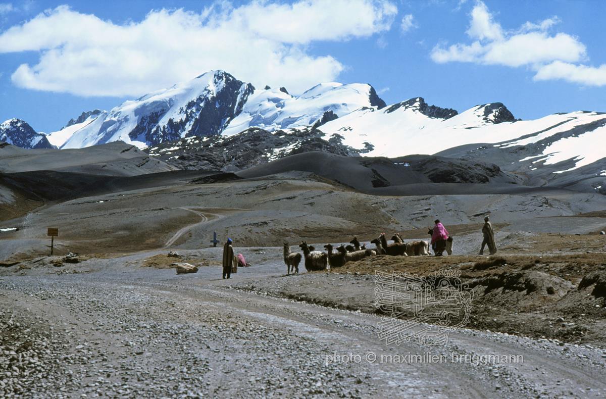
From the La Paz basin, the road climbs over 1,000 metres to the La Cumbre pass (picture) at an altitude of 4,643 metres, before descending into the Yungas via countless hairpin bends through a deeply incised U-shaped valley, with the Cordillera Real towering in the background. The treeless scrub and grassy vegetation of the Puna still covers the saddle here, where indigenous people are resting with a herd of llamas. A little further down the valley, scrub begins to appear, until finally a dense forest takes over. - Book: Picture 2 - Bolivia - 1976
  • Keywords:
    South America Bolivia Cordillera Real Andes Central Andes Berger Lama Alpaca landscape

Description

  • Foto Number: AND-397

From the La Paz basin, the road climbs over 1,000 metres to the La Cumbre pass (picture) at an altitude of 4,643 metres, before descending into the Yungas via countless hairpin bends through a deeply incised U-shaped valley, with the Cordillera Real towering in the background. The treeless scrub and grassy vegetation of the Puna still covers the saddle here, where indigenous people are resting with a herd of llamas. A little further down the valley, scrub begins to appear, until finally a dense forest takes over. - Book: Picture 2 - Bolivia - 1976

  • Keywords:
    South America Bolivia Cordillera Real Andes Central Andes Berger Lama Alpaca landscape

Website © 2026 pb + StratLabs
Copyright © Estate of Maximilien Bruggmann for all photos. Any use for commercial purposes prohibited.
flag flag flag flag